
- Project management
- Configure data capture catalogues including attributes & picklists
- Data collection review
- Sketches
- Data export & sharing
- Dashboards
- User management
- Scheduler

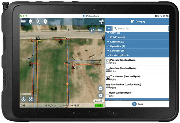
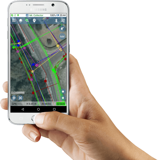
- Geolantis.360 Android app
- Connected to Trimble Catalyst DA1
- Map centric data collection
- Different base map options
- Data capture catalogue
- Attribute data entry
- Photos and notes
- Direct quality check
- Automatic sync to backend

- Define data collection template
- Create feature classes
- Define graphical representation
- Define attributes including mandatory fields
- Define pick lists
- Option to group feature classes logically
- Create a project and add details
- Define work area
- Define project owner
- Define high precision transformation set
- Add custom attributes
- Select data capture template
- Set accuracy requirements

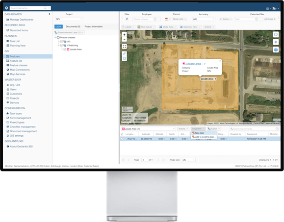
- Define the locate / work area
- Upload existing data sets
- Uploading PDF documents
- Link WMS & WFS links
- Upload georeferenced aerials imagery
- Assign task to the field worker
- Review acquired data
- Filter by location, field user, asset type, date,…
- Add offset measurements
- Export data to GIS & CAD
- Create PDF reports


Google Earth
- Export data to Google Earth
- Share data with team and externals
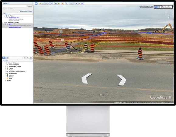
- View in 3D
- Layer filters
- Access attributes
- View Photos
- Visualize in Google StreetView
- See asset location
- Layer filters

- Geolantis shares live data through WFS to 3rd party apps
- Access data in real-time
- Collected utilities
- – Water
- – Gas
- – Electricity
- – Telecommunication
- – etc...
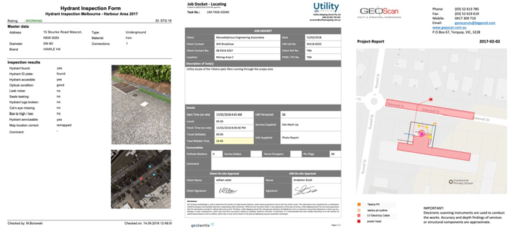
- Form Based Reports
- Inspection Reports
- Map Reports
- Pothole Reports
The mobile apps are GNSS (GPS) centric asset collection tools which give field workers access to existing infrastructure, different sorts of background maps, attributive info and documents. You'll be able to map asset data without surveying knowledge. Geolantis360 allows you to capture the asset location and its attributes, besides taking geo-referenced photos.
Excellent maps paired with precise GPS locations allow data to be captured in a fast and efficient way. It gives the fieldworker full visibility of existing assets. Boost your field crew's efficiency.
Geolantis360 ensures data accuracy, quality and integrity. The software stores all sensor information, software settings and actions for every single measured coordinate. Understand how data has been collected!
Accurate asset data collection, including notes & photo documentation paired with automatic cloud synchronisation. Eliminate any media breaks. Go fully paperless!
It doesn't matter if you have a small or big team, Geolantis360 works for everyone who wants to manage field crews and projects. It's time to replace multiple services and apps with ONE powerful solution!

Utility Mapping - Australia
“Geolantis.360TM is the only platform that aligns with our philosophy of data management, process planning and operational management – a case of GIS meets ERP. It gives us the ability to manage more with less.”
LuxConnect - Luxemburg
“One of our most important tasks is to document our fiber network as accurate as possible. The cloud-based Geolantis.360TM app leveraging precise GNSS is highly accurate and we rely on it every day to document our valuable assets. Their customer service is second to none. Geolantis is a game-changer for us.”